
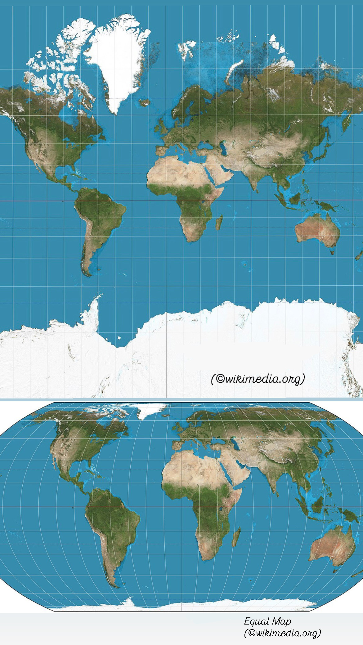
For centuries, Africa has appeared on standard maps far smaller than it actually is. Now the UN General Assembly has backed an initiative from African states, calling for a shift away from the Mercator projection towards a more accurate map known as Equal Earth, which preserves the true relative sizes of the continents. The resolution passed with 164 votes in favour and one against — the United States. Six countries abstained: Estonia, Georgia, Lithuania, Moldova, Serbia and Ukraine.
The problem lies in the Mercator projection itself, devised in 1569 for maritime navigation. It greatly inflates territories closer to the poles and shrinks those near the equator. That is why Greenland looks almost comparable in size to Africa (see the map in the first illustration), even though Africa is roughly 14 times larger. Europe and North America likewise appear visually bigger relative to Africa and other regions of the Global South.
The Correct the Map campaign was driven by Togo and the African Union. As Togo’s foreign minister, Robert Dussey, put it: maps shape how we understand the world. They influence education, imagination and the way countries and regions are perceived. For African states, this makes the issue not merely cartographic but symbolic — the familiar map has spent decades visually diminishing the scale of the continent.
The resolution does not ban the Mercator projection. It recommends that governments, schools, international organisations, media outlets and technology companies use Equal Earth and other equal-area projections wherever conveying the true size of territories matters.
For Africa, this is quite literally an attempt to reclaim its place on the map — one that matches its real proportions.


